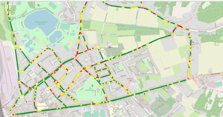
Road Data
& Quality Analysis for Road Construction and Road Maintenance

Road data include 3D geometrical data, intensity data, camera images, and detailed GPS information, all synchronized in a consistent dataset. Generic data sets cover city roads, regional roads, highway, or even off-road data.
ROAD PROFILE OVERVIEW
The generic data set consists of
- 3D geometrical data of full lane width and more
- cross-sections in longitudinal directions can be obtained with simple Matlab script or in XenomatiX software, XenoWare
- Intensity data outlining the presence and quality of road markings
- camera images, synchronized with the 3D and intensity data
Note: other quality analyses can be requested
Watch the live demo, here
Request Virtual Demo
Road data includes 3D geometrical data, camera images, and detailed GPS information, all synchronized in a consistent dataset. Customized data sets cover any road, off-road, quay, or runway the customer is interested in.
Additional sensor data can be added, provided by the customer’s sensor equipment, synchronized to a consistent and complete data set where feasible. The different quality indices, if required customized, can be offered for these data sets.
ROAD PROFILE OVERVIEW
The customized data set consists of
- 3D geometrical data of full lane width
- cross-sections in longitudinal directions can be obtained with simple Matlab script or in XenoWare
- Intensity data outlining the presence and quality of road markings
- camera images, synchronized with the 3D and intensity data
Watch the live demo, here
Request Full DemoWe deliver raw digitized data with customized and processed analysis. Road data include a 3D point cloud, intensity data, camera images, and detailed GPS data.
ROAD PROFILE OVERVIEW
Basic analysis:
- IRI (International Roughness Index)
- Longitudinal Evenness
- Transversal Evenness
- Rutting index
Advanced analysis:
- Potholes index
- Crack index
- Road markings index
- On-demand index
Watch the live demo, here
Request Full Demo
GET IN TOUCH! Contact our experts
Why XenomatiX?
-
Quick set up
-
High accuracy
-
3D pointcloud & 2d images
-
Reliable
-
Multi-beam
-
No moving parts
-
Flexible
-
Scalable & affordable
